Tropical Cyclone Cody caused damage in Fiji earlier this week and is slowly moving away from Fiji. Now it could bring flooding rains and damaging winds to parts of Aotearoa.
The category 1 storm left one person dead, caused widespread flooding which forced close to 2,000 people to flee their homes and seek shelter at 110 evacuation centres activated across Fiji.
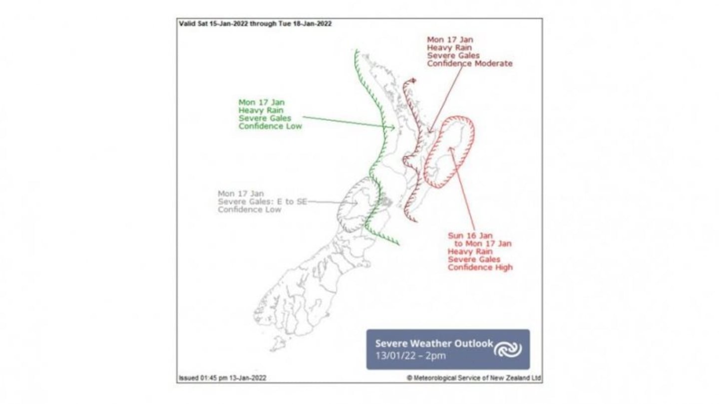
MetService issued a media statement today saying "very' stormy weather is expected to hit sections of the North Island and upper South Island.
On Sunday, the effects are expected to start in the north and move south.
MetService is unsure exactly where the storm will have the most impact, although the Coromandel, Bay of Plenty, Gisborne, and Hawke's Bay are expected to be hit the worst.
MetService will have a better idea of the direction Cyclone Cody will travel by midday Friday and will issue Severe Weather Watches and Warnings for each region, which will include additional detail and possible impacts.
Significant waves are forecast to reach the eastern coastlines of Aotearoa from the Northland to the Banks Peninsula on Saturday through to Tuesday, posing a major risk of inundation for beachside and low-lying regions.
MetService Meteorologist April Clark warns, “Though Cyclone Cody will no longer be a tropical cyclone by the time it affects New Zealand, this doesn’t mean it will have lost any of its sting. Currently, the exact path Cody will take over New Zealand during Sunday and Monday has significant variability, but it is clear that the upper two-thirds of the country will see some form of severe weather from the system and the north and east will get large swells.”
Because many people are still vacationing at beaches and camping sites, MetService is urging people to share this information about Cyclone Cody with their relatives and friends.
Please stay up to date on the latest forecasts and be prepared to change your plans if Cyclone Cody hits your area.


